Peter's Bridges Quiz
This quiz contains 25 OS map extracts, all taken from current on-line mapping, showing road bridges in Great Britain. All you need to do is identify them. Send your answers to me by e-mail.
They are all at the same scale, north is always at the top, and most identifying text has been removed. Some are easy, some are much harder, so e-mail me with the ones you know. Hopefully, this should be easier than the "Off the Beaten Track" quiz I did a couple of years ago, as some of these bridges are very well-known.
A warning: on at least one map extract, the legend "Toll" has been removed.
I have now added the answers. Thank you to everyone who took part.
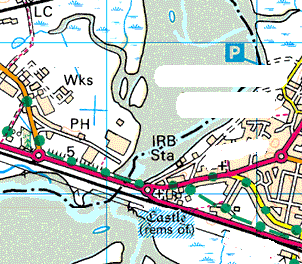
Question 1
This is east of a large town once famous for the manufacture of saucepans
A484, Loughor, South Wales (the town in question being Llanelli)
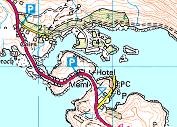
Question 2
In a very remote and rugged area, it looks as though this bridge has replaced a ferry
A894, Kylesku, Northern Scotland
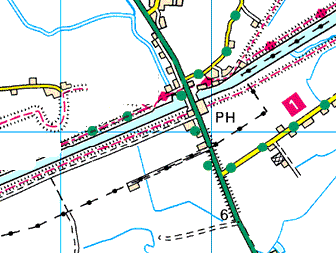
Question 3
Flat land and straight lines give a strong clue as to which part of the country this is in. The First 99 road crossing the bridge has been described on SABRE as one of the dullest in England
A17, Fosdyke, Lincolnshire
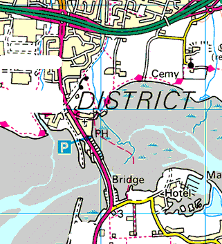
Question 4
Connecting an island to the mainland, it looks like there was once a railway bridge here too
A3023, Langstone, Hampshire - linking the mainland to Hayling Island
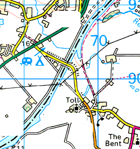
Question 5
The toll is not over the major bridge – and why does the bridge need to be so high to cross a non-tidal inland waterway?
Warburton Bridge, over the Manchester Ship Canal, Greater Manchester
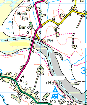
Question 6
This is just to the east of one of the UK's major seaside resorts
A588 Shard Bridge, east of Blackpool, Lancashire
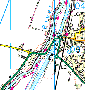
Question 7
Not too far from Q3 – where would you expect to find big man-made drainage channels?
A1122, Downham Market, Norfolk
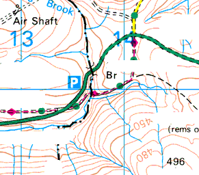
Question 8
This Highways Agency controlled road forms part of the route between two of the UK's biggest cities. What is that air shaft for?
A628 Saltersbrook Bridge, Derbyshire (on the Manchester-Sheffield trunk road)
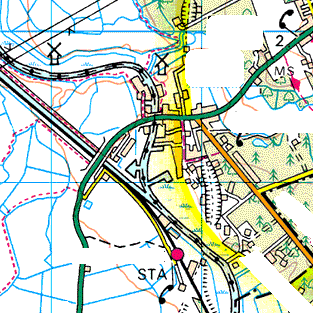
Question 9
What is that yellow boundary?
A143, St Olaves, Norfolk - the boundary is that of the Norfolk Broads National Park
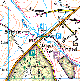
Question 10
Probably the best-known clapper bridge in the UK
B3212, Postbridge, Dartmoor, Devon
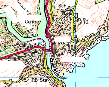
Question 11
The bridge links the two parts of this town, which are known as East ? and West ?
A387 connecting East and West Looe, Cornwall
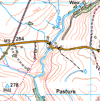
Question 12
The scene of a notorious coach crash in the 1970s, and also has a connection with the "Top Cat" TV cartoon show
B6265, Dibble's Bridge, North Yorkshire (between Grassington and Pateley Bridge). The coach crash here in 1975 was Britain's single worst road accident in terms of loss of life
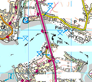
Question 13
A large modern bridge spanning a deep inlet – there aren't too many of these around
A477 crossing the Cleddau, Pembrokeshire
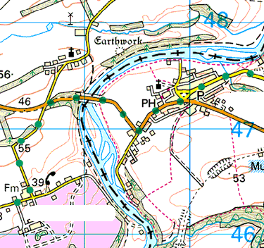
Question 14
The boundary is an obvious clue. The village has an impressive ruined castle that features in the works of Sir Walter Scott
B6470, Norham, Northumberland
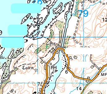
Question 15
This bridge is said to "span the Atlantic"
B844 Clachan Bridge, near Oban, Scotland, connecting the island of Seil to the mainland and thus spanning the slightly smaller half of the Atlantic
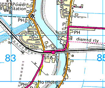
Question 16
There aren't many rivers this big on a N-S axis. Looks like a rather industrial setting
A18, Gunness, Lincolnshire, crossing the Trent
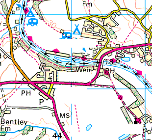
Question 17
A much more salubrious setting on one of Britain's longest rivers
A4133, Holt Fleet, Worcestershire, crossing the Severn
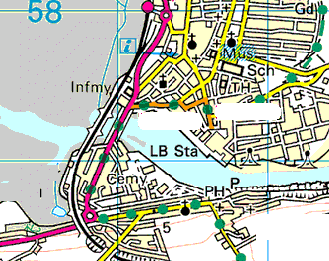
Question 18
To the left is an inland tidal basin, not the sea
A92, Montrose, North-East Scotland
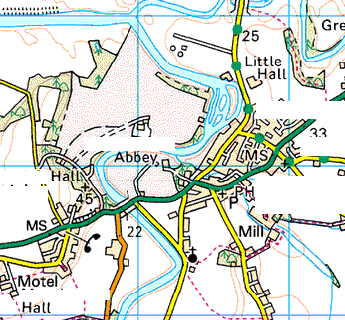
Question 19
This pastoral-looking landscape is just to the east of a historic cathedral city, but perhaps not where you first thought of looking
A69 Warwick Bridge, Cumbria, east of Carlisle
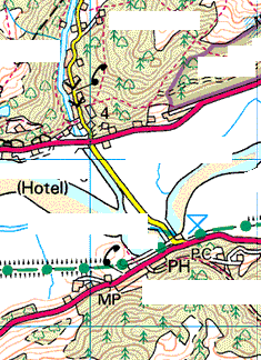
Question 20
A westward-flowing, tidal estuary between steep wooded hills should narrow down the areas to look at
Penmaenpool, Merioneth, Wales, west of Dolgellau
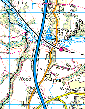
Question 21
A unique spot where a single-digit motorway crosses river, canal, railway and road
M6 Gathurst Viaduct, west of Wigan, Lancashire
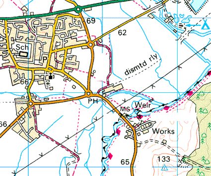
Question 22
At the top of the map is a First 99 A-road that originally ran across the bridge shown
B4044 Swinford Bridge, Eynsham, Oxfordshire - the First 99 road being the A40
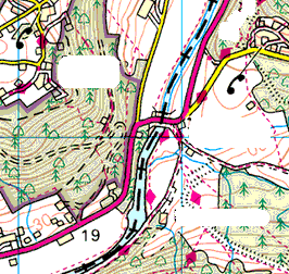
Question 23
The boundary and the fact this is the highest tidal point of the river should help narrow this one down
A466 Bigsweir Bridge, over the Wye on the boundary of Gloucestershire and Monmouthshire
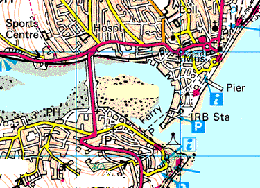
Question 24
The current bridge was built in 1931 and was originally tolled. Despite appearances, this is not on the east coast
A379, Teignmouth, Devon
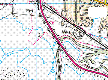
Question 25
This bridge links an island to the mainland. Muddy, tidal creeks are most common around the estuary of a particular major river
A130, Canvey Island, Essex